Brest (Horad Brest)
 |
Brest is a historical site for many cultures, as it hosted important historical events, such as the Union of Brest and Treaty of Brest-Litovsk. Furthermore, the Brest Fortress was recognized by the Soviet Union as a Hero Fortress in honour of the defense of Brest Fortress in June 1941.
From Late Middle Ages to 1795, the city was part of the Grand Duchy of Lithuania, which later became a part of the Polish–Lithuanian Commonwealth from 1569. In 1795, it was incorporated into the Russian Empire with the Third Partition of Poland. After World War I, the city became part of by the Second Polish Republic. In 1939, during the Invasion of Poland by Nazi Germany and the Soviet Union, the city was first captured by the Wehrmacht and soon passed on to the USSR per the German–Soviet Frontier Treaty. In 1941, it was retaken by the Germans during Operation Barbarossa. In 1944, it was taken by the Soviet Red Army during the Lublin–Brest offensive. The city was in the Belarusian SSR until the breakup of the USSR in 1991. Since then, Brest has been part of Belarus.
Several theories attempt to explain the origin of the city's name. It may have the Slavic root beresta meaning "birch", or "bark". The name could also originate from Slavic root berest meaning "elm". It could likewise have come from the Lithuanian word brasta meaning "ford".
Once a center of Jewish scholarship, the city has the Yiddish name בריסק (Brisk), hence the term "Brisker" used to describe followers of the influential Soloveitchik family of rabbis. Traditionally, Belarusian-speakers called the city Берасце (Bieraście).
Brest became a part of the Grand Duchy of Lithuania in 1319. In the Polish–Lithuanian Commonwealth formed in 1569, the town became known in Polish as Brześć, historically Brześć Litewski (literally: "Lithuanian Brest", in contradistinction to Brześć Kujawski). Brześć became part of the Russian Empire under the name Brest-Litovsk or Brest-Litovskii (Брест-Литовск, Брест-Литовский, literally "Lithuanian Brest") in the course of the Third Partition of the Polish-Lithuanian Commonwealth in 1795. After World War I, and the rebirth of Poland in 1918, the government of the Second Polish Republic renamed the city as Brześć nad Bugiem ("Brest on the Bug") on 20 March 1923. After World War II, the city became part of the Byelorussian Soviet Socialist Republic with the name simplified as Brest.
Brest's coat of arms, adopted on 26 January 1991, features an arrow pointed upwards and a bow (both silver) on a sky-blue shield. An alternative coat of arms has a red shield. Sigismund II Augustus, King of Poland and Grand Duke of Lithuania, first granted Brest a coat of arms in 1554.
Map - Brest (Horad Brest)
Map
Country - Belarus
 |
 |
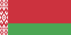
| Flag of Belarus | |
Until the 20th century, different states at various times controlled the lands of modern-day Belarus, including Kievan Rus', the Principality of Polotsk, the Grand Duchy of Lithuania, the Polish–Lithuanian Commonwealth, and the Russian Empire. In the aftermath of the Russian Revolution in 1917, different states arose competing for legitimacy amid the Civil War, ultimately ending in the rise of the Byelorussian SSR, which became a founding constituent republic of the Soviet Union in 1922. After the Polish-Soviet War, Belarus lost almost half of its territory to Poland. Much of the borders of Belarus took their modern shape in 1939, when some lands of the Second Polish Republic were reintegrated into it after the Soviet invasion of Poland, and were finalized after World War II. During World War II, military operations devastated Belarus, which lost about a quarter of its population and half of its economic resources. The republic was redeveloped in the post-war years. In 1945, the Byelorussian SSR became a founding member of the United Nations, along with the Soviet Union.
Currency / Language
| ISO | Currency | Symbol | Significant figures |
|---|---|---|---|
| BYN | Belarusian ruble | Br | 2 |
| ISO | Language |
|---|---|
| BE | Belarusian language |
| RU | Russian language |


